Tuesday, November 7, 2023

Confessions of an Novice Packrafter


Of the four seasons, fall is perhaps the most transitory. Sure, nausea-inducing Pumpkin Spice Season drags on forever, but the actual epoch of colorful leaves only lasts a couple weeks. Two weeks ago, the colors were at their peak in Michigan. One week later, all those leaves had fallen, whereupon I spent some quality time bonding with the leaf blower. So when a beautiful weather window presented itself this weekend, I knew I'd have to head south to catch the last vestiges of color.

Indiana has exactly one Wilderness area, the Charles C. Deam Wilderness near Bloomington. A series of steep hills and incised ravines cut through the landscape, all bordered to the north by a large reservoir. Speaking of water though, I found relatively little of it. Every time I dipped down into a hollow, I'd find a mostly-dry stream bed, sometimes punctuated by a couple pools of tannic water. Spelunkers love the Swiss cheese limestone bedrock of Kentucky and southern Indiana. But for backpackers, it's a bit annoying that streams appear and disappear seemingly at random. Karst topography makes for an unpredictable water situation.

At any rate, the Deam features a well-developed trail network. I strung together several of these trails into a 30-mile loop. Given that a couple of the trails dead-ended at different points along the Lake Monroe shoreline, I couldn't resist the opportunity to take my new packraft out for a spin.

Packraft? Yes indeed. A compact, inflatable boat designed to be carried in a backpack. Including a paddle and life jacket, the whole kit weighs about 6 pounds. I primarily plan to use it in order to explore tough-to-access landscapes. Oftentimes in southern Utah, I hike from the top of a canyon down to where it empties into one of the Colorado Plateau's major rivers. Without a packraft, I have no choice but to return the way I came. With a packraft however, I can float down the river and the journey can continue. Rivers and lakes, once obstacles to forward progress, suddenly become conduits.

The packraft wasn't the only nicety that I brought on this trip. I toted an isobutane stove, and my trusty pair of $4.36 knockoff Crocs purchased four years ago from Walmart in Las Cruces, NM. I typically forego the stove and camp shoes, but given the long November nights, it made sense to carry a couple extra pounds to be more comfortable in camp.


Day One

The first day dawned bright and sunny, albeit a bit chilly. I was feeling cozy, and it wasn't until the sun was fully up that I reluctantly emerged from the cocoon in the back of my car. It wasn't entirely clear whether I was actually parked in a designated area or not, and trailhead fee verbiage was unclear, so I chucked a long-expired America The Beautiful pass on my dashboard and hoped for the best. 

I crunched my way through the forest as sun began to filter through the oaks and sycamores. Oak has a tendency to underwhelm; its leaves often go directly from green to brown, or at best sport a sickly maroon twinge for a few days. The sycamores were a bit more impressive. Several were yellow - perhaps not the brilliant yellow of an aspen or cottonwood, but delightful all the same. A couple trees stood out with a bit more orangey coloration. There would be crimson maples on this trip, sadly. 

I did appreciate, however, the sounds of fall. Either the region has been quite dry recently, or else someone's been curating the forest floor for maximal crunchiness. Even while walking right on the trail, I was trudging through several inches of freshly fallen, crispy leaves in a delightful cacophany that practically screams "autumn". I pitied the deer around here; there'd be no sneaking away from hunters. On the other hand, neither could the hunters move without themselves creating a racket. Mutually Assured Decibels, I grinned to myself. 


I wound my way down a series of switchbacks into a ravine. To my surprise, I found no flowing water, just a small puddle. I wouldn't find any flow in the next hollow either. In fact, I didn't see any flowing streams for the entirety of my three days in the Deam. Karst strikes again! I found puddles in several ravines, but much of the water has been discolored by tannins. It looked like iced tea, but generally tasted fine. After years of drinking from desert cow-poop sources, my "acceptable water" standard is pretty low, but pickier backpackers might have grimaced. 

The little-used trail wound its way over a series of ridges. I gained and lost a surprising amount of elevation. Though the hills weren't huge, the trail always seemed to be climbing or descending. It was well-graded and pleasant though, with a few switchbacks when the terrain demanded it. I met a couple horsepackers and fellow weekend backpackers along the way, but the trail was mostly quiet until I reached the fire tower.

Fire towers are always a crowd-pleaser, particularly when they're easily accessible. A dirt road bisects the Wilderness to allow access to the fire tower. When I got there, the parking lot was full, yet I had a few quiet minutes between groups at the top of the tower. It's the only remaining fire tower left in the Hoosier National Forest. Nationally, the few that still exist are often locked and sealed with barbed wire, so getting to look out over the forest on a sunny day was a real treat.

Eventually, it was time to leave the crowds and return to the comfort of the woods. I dropped down a series of switchbacks on a hiking-only trail. I paused to water up in a random puddle before making the climb back up to the ridgetop where I made camp.


Day Two

I woke up almost giddy. After a pot of hot chocolate, I made quick work of the few miles down a spur trail that led to the shoreline of Lake Monroe. There, I inflated my packraft and tiptoed around the deep, gloppy muck that rings the reservoir. I flopped into my boat with all the grace and dignity of a beached seal and paddled out a few hundred yards into the lake... and only then realized I'd left my trekking poles on shore. Sigh. Time to retrace my steps.

To make matters worse, I couldn't find the exact path that I'd used to avoid the calf-sucking mud the first time around, and got deeply, hilariously mired as soon as I got out of the raft. I hoped there was nobody watching from shore, as I was train-wrecking real hard. Each footstep was followed by thirty seconds of squelching as I attempted to extract my Croc from the mud. I had to retreat to the boat and paddle up and down the shoreline, probing different spots, before I finally found one that wasn't too squishy. Chastened, I grabbed the poles, slunk back to my packraft and set sail again. 


The rest of the rafting segment involved a lot more beauty and a lot less drama. I paddled about 4 miles of flat water across the open lake. Conditions were perfect - glassy-calm, not even the slightest breeze, beautiful sunshine, and no bugs at this time of year. I stopped for a littoral lunch on a convenient piece of driftwood, and continued a short distance to my destination, the end of a prominent peninsula that juts out into the reservoir. The peninsula is the most popular area in the Wilderness, and accessing it via the water, rather than the trail felt sneaky and fun. I set up an early camp on the tip of the peninsula, surrounded by cypress knees. I paddled around the shoreline for a while, experimenting with my boat to see how it handles, and generally romped around. 


I quit a bit early that day. I'd managed to drip quite a bit of water on everything (a consequence of splashy, inefficient paddle strokes) and I wanted to dry everything off before the sun got too low in the western horizon. I practiced deploying and stowing my boat a few times to work out the kinks and build muscle memory.

Dinner that evening was another stove affair - coucous with tuna, if you care to know. The wind was still calm and I caught a decent sunrise over the lake. Today was the first day of Standard Time, and sunset at 5:30pm reminded me of the doldrums to come. I gulped hot chocolate and nestled into my quilt for the night. 


Day Three

The slightest of breezes was beginning to kick up when I awoke. I knew a front was moving in later in the day, so I got up early and kept moving to stay ahead of it. I followed the famous Peninsula Trail to where it connected with the rest of the trail network, then turned off on a seldom-used, quasi-abandoned trail back to my car. A couple nice ridgetop views, a few dozen blowdowns, and one particularly brilliant sycamore later, I found myself at my car - thankfully not towed, ticketed, or totaled. Small victories, right?


Overall

I'm far from an expert on Indiana, but there seems to be a consensus that the Deam Wilderness is some of the best backpacking in the state, perhaps the best. I understand why. There's some interesting topography, a fire tower, a lake, even a few geodes to be found. Using a packraft really jazzed up the trip. I'm solidly in the "bumbling idiot" phase of the learning curve, but truth be told, I'm enjoying the process. I'm having fun picking up a new skill, especially one that will help expand my range of future trip possibilities.


Saturday, October 14, 2023

PCT Part 4: Mt Shasta to Kennedy Meadows


For ten years, the Pacific Crest Trail seemed to be a sort Zeno's Paradox. It was something to look at from afar, or to tease on my blog, or to approach asymptotically. Actually hiking it seemed always slightly beyond the horizon. Apparently though, change is not an illusion, because I've completed the Pacific Crest Trail. Enough philosophical rumination though; let's get into the guts of the thing.


Merely Treading Water

On any long hike, there's a period of.. I dunno, let's call it malaise. Such was my experience through much of north-central California. It wasn't one thing in particular, but rather a confluence of factors. For starters, I walked through hundreds of miles of burn area. The entire PCT through Lassen National Park was a smoking crater of charcoal and despair. I hitchhiked into Quincy with a formerly-retired gentleman who'd lost everything - all his earthly possessions - in 2021's disastrous Dixie Fire. He's now back to work at a local campground, trying to make ends meet. I suspect his heartbreaking story will repeat itself more and more as the West gets warmer and drier.


After the burn areas came the rain. A couple weeks earlier, I had jettisoned my tent and rain gear in favor of my lighter poncho-tarp. This decision was based on research into seasonal climate averages, and was in fact a sound decision. Unfortunately, the weather around the end of August was unseasonably cold and wet. A hypothermia-inducing three day rainstorm took its toll on my morale. I picked up a shoddy polka-dotted umbrella for eight dollars at a Dollar General, which gave me an additional layer of protection from the deluge. Still, there are few things in the world more viscerally unpleasant than walking through 38-degree rain - fingers numb blocks of concrete - for hours on end. 

After the rain came the postal misadventures. I bought a bunch of food in Chester, CA and mailed it ahead to the thinly-stocked town of Sierra City. Imagine my surprise, then, when the box showed up not at the Sierra City post office, but at my return-address in Michigan! I ended up cobbling a meager and pricey resupply in Sierra City, consisting mostly of peanut butter and potato chips. 

After the postal misadventures came the Toe Thing. My left big toe started complaining. This isn't unusual on a thru-hike; generally there's at least one painful/annoying/freaky thing happening with my feet at any given time. Turns out the Lord doesn't warranty us for 15,000+ miles of backcountry hiking! Usually I just power through, and it goes away on its own after a couple days/weeks. But this Toe Thing just kept getting worse, despite diligent daily applications of Neosporin and chutzpah. Finally, I caved and visited a clinic in the Lake Tahoe area, where I was diagnosed with an infected, ingrown toenail. A photo appears below.

Nah, just kidding. 

Anyhoo, the doctor sliced and diced my toenail, and told me to stay off it for a week while things healed up. Ha! Fat chance. But I did phone my good pal Blue Moon, who lives in Reno. He graciously accommodated my stinky self at his house for four days. It wasn't a full week, but I was getting antsy. I also swapped out my fast-and-light Northern California gear for more burly cold-weather gear as I prepared to enter the final stage of my journey, the Sierra Nevada.

Refreshed after after my time off, but still missing my mojo, I headed south from Tahoe toward my next stop at Sonora Pass.


A Turning Point

A few weeks earlier, I'd chatted with my older sister on the phone. Off-hand, I mentioned how much I was missing certain tastes of home - chief among them, steaks from the world's foremost grillmaster, my brother-in-law Josh.

Remember that Sierra City box that ended up in the wrong state? Well, I asked my family to forward it to me at Sonora Pass instead. And when it showed up, it contained not just my usual Teddy Grahams, crushed Doritos, and Peanut M&Ms, but a gallon Zip-lok full of Josh's grilled steaks. The admittedly risky food-storage practices amused and/or horrified all the hikers around me at the time (bets were placed on the odds of me puking my brains out), but I can testify that nothing in the world has ever tasted better than room-temperature meat out of a plastic bag. And I didn't puke my brains out, so that's a plus.

It's funny how something as simple as a steak can completely change the course of an entire month. Coming into Sonora Pass, something seemed... off. The hike over the last couple weeks had proven itself to be a slog. But by time I left Sonora Pass, the script had flipped completely. A taste of home and a little dose of family had re-energized me for the final stretch. 

The Sierra Immersion Project

I'd saved the best for last. One key benefit of a flip-flop itinerary was finishing the Triple Crown with the crown jewel of the PCT - the Sierra Nevada.

From the moment we set foot on trail, PCT southbounders race winter. I started my southbound leg on July 7, and had less than three months to hike nearly 2,000 miles. Once October rolls around, the probability of a season-ending snowstorm in the Sierra increases dramatically. I resolved to get through the Sierra by the end of September.

My Sierra strategy, therefore, was based on three key considerations:

  1. The inexorable march of the seasons. Winter was already on its way.
  2. Logistical concerns. Most key resupply points in the Sierra had already shut down for the season.
  3. Aesthetic preferences. I wanted the culmination of my PCT and Triple Crown experience to be a true wilderness immersion.

In the final 320 miles of my PCT journey, I crossed only one road (in Yosemite National Park), and the final 240 miles were entirely roadless - a contiguous bloc of designated Wilderness almost unrivaled in the lower 48. Although the Sierra is at best Wilderness Lite (I saw multiple groups of people every day because it's California), the unspoiled terrain brought back fond memories of some of my other favorite wild places - the Greater Yellowstone, central Idaho, the Escalante, etc. 

In this spirit of wilderness immersion, I opted to do a pair of long food carries - 6 and 8 days respectively - and resupplied by boat ferry at an isolated, off-grid lake resort in the mountains. As much as I enjoy plentiful town food and broadband, dipping back into the city wasn't how I wanted to finish my Triple Crown. Normally the length of those food carries wouldn't be notable, but I had to cram all my food into a bear canister, which is required equipment in the Sierra. I ended up packing and repacking that bear can endlessly, trying to be as efficient as possible with the space. Finally, I ended up doing CPR on my food, smashing everything to smithereens in order to wedge a few more Kit-Kat bars in the top. Altogether, the full bear can weighed at least 20 pounds. To make matters worse, the bear can didn't really fit comfortably inside my pack without awkwardly pressing on my spine, so I had to strap it to the top of my pack. I spent the next several days teetering with that inverted pendulum knocking me off-balance with irritating regularity. 


Coming Full-circle

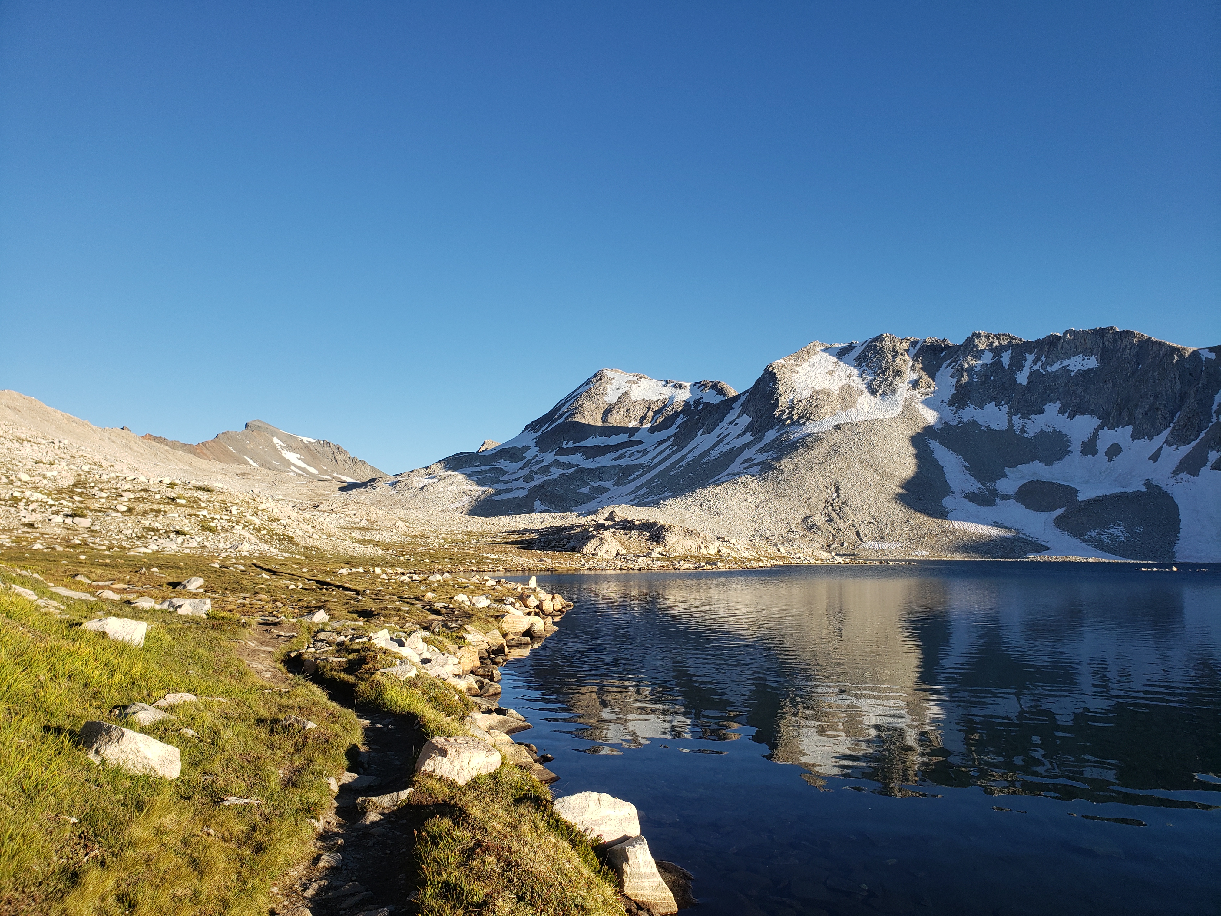
In the core of the high Sierra, thru-hikers have eight major passes to climb, ranging from 11,000-13,000 feet in elevation. These passes are by far the most physically difficult feature on the PCT - especially with all that food weight on my back. But it was hard to complain too bitterly; this was the Platonic ideal of high country, with gorgeous blue lakes, granite walls, and even a few lingering wildflowers that hadn't gotten the autumn memo yet. During my week crossing these passes, I saw not a single cloud. Brilliant blue skies reigned. Although it was chilly (I wore everything I owned for about eighteen hours per day), the weather held up perfectly. 

Atop the last pass (Forester Pass, the PCT's highest point), I heard a rumor of an approaching snowstorm. A backcountry ranger corroborated the forecast a couple hours later, and it became clear that my extra day of food was going to be used for weather delays, rather than a side trip to Mt. Whitney, the highest peak in the lower 48. On two consecutive days, I stopped early in order to camp as low as possible (just under 10,000 feet). At that elevation, about four inches of snow fell, though storm intensity certainly increased exponentially with elevation. 

Truth be told, I rather enjoyed the snow. It was a perfect bookend to my AT hike ten years ago, where I dealt with seemingly-continuous snow and cold for the first month of the trail. A decade of experience hence, the weather gave me a chance to reflect on my growth as an outdoorsman and, more importantly, the faithfulness of God through the years.


I didn't set out to become a Triple Crowner. It just sort of happened. I wish I could say that finishing the PCT at a nondescript road crossing in the sagebrush near Kennedy Meadows was some sort of ecstatic epiphany, but that wouldn't be entirely accurate. In fact, the most remarkable aspect of my PCT finish was the sunshine. I've finished every other thru-hike (even the desert trails) in something between a mist and a deluge. The PCT was warm, sunny, and gave me a chance to savor the journey, if only for a moment.

We'll leave it here for now. I'll probably do a follow-up post about the PCT as a whole and the Triple Crown; I've got a few themes to weave together still. In the meantime, enjoy the lovely Sierra landscape. 


Wednesday, August 23, 2023

PCT Part 3: Canada to Mt Shasta

Yep, I've gone parts of three states and more than 1,000 miles without updating the blog. I'd apologize, but at this point it should be clear that I always do this on a long hike, and I'm only kind of sorry.

At any rate, I've still got 15 more miles to hike before dark tonight, so let's jump straight into the highlights:

Washington... was some of the most beautiful hiking I've ever done. Nearly every day held something particularly striking and beautiful. Lower elevation sections featured immense old-growth trees, the kind that you can only find in the northwest, and brilliant green ferns. Upper elevations held wildflowers and lingering snow patches. While I wouldn't necessarily like the Cascades to be my home base (thick vegetation makes off-trail exploration tedious), visiting the best of this wonderful range was a real treat.

Oregon... was a mixed bag. Certain parts were magical: the Three Sisters Wilderness, the bizarre and amazing Tunnel Falls (reminiscent of the behind-the-waterfall shortcut in Mario Kart 64), and of course the incomparable Crater Lake. But in truth, I was a little underwhelmed by the PCT's routing through Oregon. It seemed like at least a quarter of the trail through the state was burn area - sometimes a fresh, lunar-surface char, sometimes a decades-old burn that now resembles a Christmas tree farm. Either way, those miles offered little in the way of shade or scenic value. A friend assures me that (much like the CDT through the Greater Yellowstone), Oregon holds lots of promise, and the PCT fails to visit most of the good stuff. Perhaps a third long hike in Oregon awaits me someday!

To keep my spirits up in Oregon, I did two things. First, I picked up a 7.5" lightweight folding saw and did some impromptu trail work. The PCT is generally pretty well-maintained, but after a few years of Covid and big snow years, there are some areas of annoying blowdowns, particularly in the burn areas. I had to start limiting myself to ten blowdowns a day, otherwise I'd just spend all my time cutting and never make my miles. The saw lasted all of a week before I tried cutting a tree that was right at the limit of the saw's capability... and pinched it, breaking the blade. Oh well, it was fun while it lasted. At some point, I'll probably pick up another one. There's a certain degree of reward that comes with helping improve a trail, rather than being just a mere consumer.

Jinxed It: Second, I made my own route. Congrats to everybody who saw that coming! A day before I reached Ashland, the Forest Service closed more than 100 miles of trail in northern California for fires. To date, I'd hit zero fire closures, which was certainly a rarity. While this closure was obviously a disappointment, it offered me the opportunity to engage the route-creator side of my brain. I mapped a 100+ mile re-route that avoided the fire closures and the worst of the downwind smoke areas. It went through a National Monument, two National Forests, and one BLM-managed Wilderness area. It was pretty quick-and-dirty, and at one point an unexpected private property issue forced me to do an additional 25 unpleasant miles on pavement. But overall, it was fun to escape the tyranny of the Red Line for a little bit. Plus, I connected my footsteps around the fires, which does remain strangely important to me. 

Aesop's Thru-Hike: On my first thru-hike, I watched older, more experienced hikers carefully. I found that they spent much less time in town than did the twenty-something crowd. They got up early, never did huge miles, but never took much time off either. Despite the fact that they didn't hike fast, they maintained a good pace over the course of weeks or months, because they were slow-and-steady... the tortoise, rather than the hare, in Aesop's fable.

I've never been a fast hiker. But I found that I too could maintain the pace necessary to complete a thru-hike if I minimized town time and maximized trail time. On the PCT, I've taken that strategy to its logical extreme. Since starting the southbound leg in early July, I have not taken any days off, and have only hiked fewer than 20 miles on four occasions. As a consequence, I'm on pace to complete the trail before winter hits the High Sierra in a little more than a month. Just as importantly, doing a trail-oriented hike (rather than a town-oriented hike) has offered me the kind of hiking experience I relish. I avoid the drama and chaos that swirls around trail towns, and spend time truly outside. 

Holding Serve: The foot's been okay with this heavy workload, surprisingly. I ask every day for a fresh helping of God's grace (and sometimes for 'two scoops' on particularly painful mornings), and every day, he delivers. I'm getting a lot of 'yes' right now, and it's pretty clear that I'm supposed to be out here, serving him.

What's Next: There are less than 1,000 miles left in my PCT hike. Already, I'm corresponding with friends and family about logistics for the Sierra, the grand finale of my PCT hike. Next update will hopefully come after I finish.


Saturday, May 27, 2023

PCT Part 2: Idyllwild to Kennedy Meadows


I must confess, I wasn't looking forward to the first 700 miles of the PCT. While I'm certainly a desert enthusiast, I've never been particularly taken with the arid landscapes that the PCT visits in southern California. To be blunt, if you're looking for a desert hike, you can do a lot better than hiking the southern PCT. Sure, it has its nice parts, but the PCT still doesn't hold a candle to desert classics like the Arizona Trail, Hayduke, or Desert Winter Thru-Hike.

Despite the meh scenery, the first 700 miles of the PCT made for a delightful hiking experience. The trail was smooth and cruisey, the water carries were a snap in this very wet year, and logistics were easy. The trail was rarely resplendent, but I still relished it.

Adding to the interest this year were the extended sections of snow. San Jacinto was a snowy wonderland with great views and challenging snow conditions. The San Gabriels too were absolutely buried. I carried an ice axe for the majority (400 miles) of the so-called 'desert'. I truly enjoyed the snow miles, as a beautiful and interesting change-of-pace. 


Adaptation

Funny enough, the weather really did not cooperate in the desert. It seemed like whenever I was at high elevation, we had unseasonable cold weather, including rain and snow. Every time I'd drop down to the desert floor, a heat wave would hit southern California. The mercury reached 105 degrees on one occasion. Thankfully, I crossed Mission Creek 31 times that day, constantly wetting my shirt in order to stay cool. 

When I came to the infamous LA Aqueduct section, another heat wave arrived. Nearly everyone opted to hike this section at night, and I was no exception. I teamed up with pals Cruise and Shine to do 19 miles starting at 5pm, following the aqueduct across the Mojave desert floor as the sun set. Around 12:30am, I crawled into a ditch and instantly fell fast asleep. But I was hiking by 5am the next day in order to beat the heat. We did 23 miles by 4pm, having hiked 42 miles in 24 hot and exhausting hours. We caught a great ride into town and made a beeline for the swimming pool. Needless to say, the next day was a well-earned zero day.


More so than on other trails, I've been pretty aggressive about taking a siesta on the PCT. I generally get up when it's still dark and am hiking shortly after first light. But I take several hours' lunch in the shade, and hike deep into the evening. I figure that I've got 14 hours of daylight to use however I want, and I'd much rather avoid the heat of the day, even if it means getting up earlier and hiking later. It's no wonder why many hot-weather Hispanic cultures embrace the siesta - it's a survival strategy.

The Human Factor

When I mentioned to some experienced hiker friends that I was hiking the PCT, they looked at me askance. After all, I typically hike trails that see few (if any) other hikers. Even on more popular trails, I typically roll solo. So it was natural to assume I'd be a fish-out-of-water on the popular PCT. 

To some extent, that's true. Sometimes when I get into town and a large 'trail family' has taken over a laundromat, it's a bit off-putting. But mostly, I've been able to find a surprisingly amount of solitude on the PCT. Most hikers camp exclusively in campsites that are shown on the Guthook PCT . By keeping my eye on the terrain and choosing a site that's not on the map, I'm virtually assured of solitude, not only at night but also during the day, since I'm 'off-schedule', so to speak.

I've also met my fair share of great people on the PCT. First and foremost are my friends Cruise and Shine, who I met at the border and hiked with on-and-off until mile 650. I was able to congratulate them as they finished their PCT hike there - an accomplishment 13 years and three sections in the making. 

I also ran into my pal Fenway for the third time on three different trails. I didn't even know he was on the PCT until I came around a corner and heard that distinctive northeast accent. The long-distance hiking community is truly unique in that you're never more than two degrees of separation removed from anyone. I constantly ran into friends of friends from other trails. Turns out that ten years of inadvertent 'networking' pays off! 

Hard Decisions

I'll spare you the drama: I'm flipping. The Sierra is still blanketed in a record-breaking snowpack, and I frankly don't trust the river crossings during the big melt. Through the hiker grapevine, I've heard of a few groups who've already gone into the Sierra and come out alive, but by my calculus, the river crossings will get worse before they get better over the course of June and July. Long-time readers of this blog will know that I've cheated death once already in the backcountry, and frankly to push through the Sierra with this level of objective hazard would violate the sacrosanct Mom Principle that I use to keep myself safe in the backcountry. 

Is it perhaps possible (say, 10-20% chance of success) to hike through the Sierra right now? Perhaps. Could I ever tell my family with a clean conscience about the risks I was taking? Absolutely not. 

So instead, I'm going southbound (SOBO). Southbound was always my preferred direction to hike the PCT (my 2020 permit was for a SOBO hike), but at the time I obtained my permit last winter, I wasn't confident that my foot could maintain the pace necessary to successfully complete a SOBO. But my foot has pleasantly surprised me, and I'm reasonably confident that I'll be able to pull it off. As an added benefit, this itinerary means I'll be able to finish the PCT - and the Triple Crown - with perhaps the definitive crown jewel of American backpacking - the Sierra Nevada.

Northern Washington is melting quickly. I've got to stand up in my best bud's wedding in early July, and once that's done, it'll be time to turn on the jets. I'll only have three months to hike more than 2,000 miles before the weather window slams shut - an ambitious pace, to say the least. I've overhauled my gear for the first time in a decade in order to drop some additional packweight. In order to minimize town time, I'll prepare and mail myself a lot of resupply boxes ahead of time. A pace like this could perhaps be considered the 'final exam' for the Triple Crown - and Lord willing, I'm ready.

In the Meantime

Between now and then, I plan to keep my legs by hiking a section of the North Country Trail in northern Michigan while the PCT melts out. Although I grew up in Michigan, I didn't really become an outdoors adventurer until I moved to Utah, and consequently have spent very little time exploring my native state. These few weeks offer me a chance to rectify that oversight. I've swapped out the sub umbrella for bug spray. Let the games begin!