Sunday, December 29, 2019

2020: It's Always Adventure Time

 
"When are you going to do the PCT?"

As I neared the end of my CDT hike, I started to get the question. Friends, family members, and fellow hikers inquired,. They were curious. I've now completed two of the three legs of long-distance hiking's rarefied "Triple Crown". The Appalachian Trail and the Continental Divide Trail are done. The Pacific Crest Trail is next, right?

******************************************************************************************************

If you read this blog carefully (hi Mom!), you'll recognize the preceding paragraphs as coming from my 2019 look-ahead - in which I pulled a bait-and-switch and concluded that no, I wasn't doing the PCT but instead the Route In Between. In fact, I've teased the PCT a couple times on this blog, and as of yet, haven't actually done it.

It's time for that to change. This year, I'm doing the PCT. The idea of the Triple Crown isn't a major motivator for me personally, but the PCT looks beautiful and wonderful. It passes through environments I've never been to or haven't explored in detail. And it represents a fitting coda to this chapter of my life as full-time adventurer. Beyond just the PCT though, I intend on doing a long-distance hike in each of the four time zones in the contiguous United States - Eastern, Central, Mountain, and Pacific.

Eastern: The Florida Trail (January-February)

The Florida Trail is 1100 miles long and runs nearly the length of Florida. It begins just north of the Everglades and terminates near Pensacola. I'll admit upfront that the FT is probably the hike I'm least excited about this year. And it's the one I'm most nervous about, because of my entirely irrational fear of crocodiliforms. And that's good. A big part of the reason I'm doing the Florida Trail is because it gets me out of my comfort zone - the arid west, with its deserts and mountains and elevation change and deep wilderness. The Florida Trail is not that. It's swampy in parts, sees abundant precipitation, often urban, and has alligators! Give me grizzly bears over gators any day. Are they actually a significant danger? Of course not. Are they big and scary in my mind? You bet. 

Speaking more positively though, I expect to spend time in subtropical environments that are new to me. I'm eager to see different kinds of vegetation and yes, even an alligator or two. Combine that with some beach miles (a particular favorite of mine), and I anticipate a trail that's a change of pace, but rewarding nonetheless. Will that be the case? Only one way to find out.

Central: Ouachita Trail (March)

I intended on doing the Ouachita Trail in 2019, but simply ran out of time. The Ouachita Mountains (pronounced WASH-i-tah) parallel the Ozarks to the south, running east-west for a couple hundred miles in eastern Oklahoma and western Arkansas. It follows long ridgelines for most of its length (220 miles). 

I'm eager to compare the OT with the Ozark Highlands Trail that I hiked in 2019. Research leads me to believe that the OT is probably a "better" trail, with more views, better trail tread, and infrastructure along the way (e.g. AT-style shelters). Shelters are an absolute godsend when the weather turns bad. There's no guarantee that the weather will be bad, but given my previous experiences hiking Arkansas in March, to expect otherwise at this point would be the height of folly.

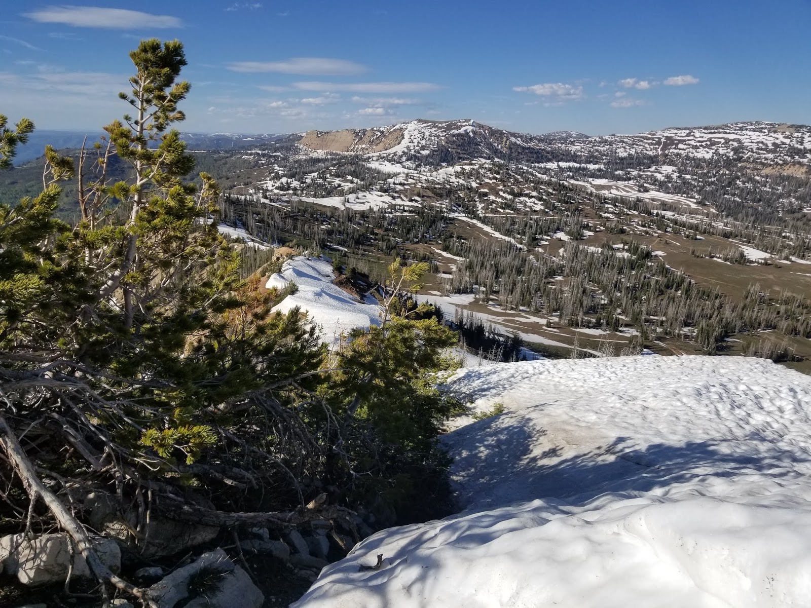
Ouachitas, viewed from the Ozarks

Mountain: Grand Enchantment Trail (April-May) 

The Grand Enchantment Trail runs 800 miles from Phoenix, AZ to Albuquerque, NM. Along the way it passes through low desert, riparian, and alpine ecosystems. The GET is another hiking "route", rather than a trail. Like the Hayduke Trail, Lowest to Highest Route, or the Route In Between, it doesn't exist except in the minds of the hikers who walk it. The GET crosses deserts and passes through wonderful riparian areas. It crosses a dozen mountain ranges over its length. The GET also links two trails that I've done previously, the Arizona Trail and the Continental Divide Trail. The GET is a natural capstone to my long-distance hiking in the Southwest, and represents for me a completion of a sort of "desert triple crown" - the Arizona Trail, Hayduke Trail, and Grand Enchantment.


Pacific: Pacific Crest Trail (July-November) 

I've met a lot of long-distance hikers over the years. They're highly accomplished folks, often with at least enough miles under their belts to circle half the globe. Everyone has their story. Everyone has a unique set of experiences. Some of them have walked the Camino de Santiago - a mixture of religious pilgrimage and roll-through-town party train. Others have braved the jungles of New Zealand and trod down muddy trails, walking the country from north to south on the Te Araroa. Others wander oft-hostile desert environs remote canyons. But whatever their other experiences, one common thread ties many of these accomplished individuals together: when they speak about their experiences on the 2600-mile Pacific Crest Trail, they get all starry-eyed.


The PCT is unique among long-distance hiking trails. I can't think of a single other trail that everybody loves. Plenty of people didn't enjoy the green tunnel of the Appalachian Trail. Plenty of people grew tired of dull roadwalks and cow poop water on the Continental Divide Trail. And a few crazy souls just didn't appreciate the arid environment of the Arizona Trail. But I've never met a single person - not one - who didn't love the PCT. A friend once commented that of the major long-distance trails, the PCT is the only one he's hiked twice - and it's the only one he'd consider hiking thrice. That alone speaks volumes. Despite different motivations, experience levels, physical capabilities, and preferred aesthetics, everybody loves the PCT - even the crusty old-timers who don't find much joy in anything anymore. How is that possible?

I obviously don't have a good answer to that question, because I haven't hiked the PCT. But I want to know. I want to be in on the joke that everyone else keeps laughing at. More than that though, I want to see what I haven't yet seen. I want to experience the Cascades for the first time, and to finally, at long last, do justice to the Sierra Nevada. I want to hike past volcanoes and across jagged ridgelines. I want to enjoy well-built, modern trail. I want to hike the Pacific Crest Trail. So in 2020, I'm doing it.

I intend on hiking it southbound, from the Canadian border to the Mexican border. And while it's arguably a little more challenging than a traditional northbound hike, it promises to be far less crowded, and allows me to have my other "time zone" adventures before starting the PCT. 

Adventure Time

There you have it. Four time zones, four long hikes, in a multitude of different environments. I'm excited about this upcoming year. At the end of the year, I anticipate a return to a more conventional lifestyle. Between now and then? It's adventure time. 


Tuesday, December 17, 2019

2019 - In Review

 
I've been writing these year-end recaps for several years now. In them, I try to come up with a word or idea to contextualize that year's adventures. It's a mere device, an ex-post-facto imposition, to somehow tell a story about the year.

This year, that's a real challenge. It was such a good year - such a diverse year. I walked on well-maintained trails in hardwood forest and picked my way through barren badlands, walked through rain forests and deserts, down road shoulders and trail-less ridgelines. I hiked trails that don't exist, trails that really don't exist, and full-blown National Scenic Trails. Yep, that's it. 2019 was the year of diverse experiences. 

Whew, now that we got that out of the way, let's hit the stats:

Gear:
  • Pairs of shoes: 6
  • Zippers split: 3
  • Tents purchased: 1
  • Tents destroyed: 1
  • Sleeping pads popped: 1
  • Sleeping pads repaired: 1
  • Platypus bottles used: 8
  • Pieces of gear mailed: infinite
  • Dollars spent on "building out" my crappy, beat-up Subaru: 30
  • Interest I have in discussing complicated hipster #vanlife projects: zero

Trips:
  • Long-distance hikes: 2 (Route In Between, Oregon Coast Trail)
  • Medium-length backpacking trips: 2 (Sand Diego Trans-county Trail, Ozark Highlands Trail) 
  • Short backpacking trips: 6
  • Miles hiked: 3,600+
  • States visited: 19
  • National Parks visited:7
  • National Park units visited: at least 19 (though I'm almost certainly forgetting a few)
  • State parks visited: dozens
  • Solo trips:7
  • Trips with friends: 3

Highest/Lowest/Fastest/Slowest
  • Highest elevation: 11,014' (Manti Skyline)
  • Lowest elevation: -236' (Salton Sea)
  • Highest point (metaphorical): Cruising the crest of the Bitterroot Range (Idaho Centennial Trail)
  • Lowest point (metaphorical): Thrashing up almost impassible trail, in the rain, with giardia (Idaho Centennial Trail)
  • Longest full day, in miles: 33 (Arizona Trail)
  • Shortest full day, in miles: 14 (Deseret Hiking Route)
  • Most consecutive days without seeing a human: 6 (Idaho Centennial Trail)
  • Longest waterless stretch: 25 miles (Deseret Hiking Route across the Snake River Plain)
  • Lightest packweight: 7 lbs (Golden Cathedral Loop)
  • Heaviest packweight: 35 lbs (Frank Church Wilderness, Idaho Centennial Trail)
 
Transportation:
  • Hassled by cops: 3
  • Given rides by cops: 2
  • Rode in the back seat of a cop car, screaming down a 2-lane highway at 90 mph with lights and sirens blaring: 1
  • Hitchhiked: 15
  • Hitchhiked with people who drove many miles out of their way to help me: 5
  • Randomly picked up by friends while hitchhiking: 2
  • Rode Greyhound: 2
  • Regretted Greyhound: 2
  • Rode Amtrak: 2

Animal Encounters:
  • Reprimanded strangers about their unleashed and aggressive dogs: 3
  • Pulled bear spray on an unleashed and aggressive dog: 1
  • Jumped into the bed of a passing pickup truck to avoid a confrontation with an unleashed and aggressive dog: 1
  • Perfectly fine encounters with well-behaved dogs: dozens 
  • Gila monsters: 3
  • Rattlesnakes: 13
  • Cows: infinite
  • Cows I thought were bears: 1
  • Actual bears: 3!!!!!! (including one grizzly)
  • Wolves: 1
  • Wolverines: 1
  • Overprotective coyote mommas: 1
  • Wild pigs: 10

Human Encounters:
  • Showed up on a relative's doorstep with a backpack: 2
  • Showed up on a friend's doorstep with a backpack: 5
  • Trail angels stayed with: 3
  • Invited home to share a meal: 2
  • Offered money by strangers who thought I was homeless: 3
  • Helped stack firewood into somebody's pickup: 2
  • 2018 CDT friends randomly bumped into on trail: 3

Camping:
  • Sleeping bag nights: 206
  • Sprinklers turned on inside my tent in the middle of the night: 1
  • Bathrooms slept in:7
  • Favorite campsite: high in the Wasatch Mountains watching the sun set over Mt. Timpanogos
  • Least favorite campsite: waterlogged marshy area in a pouring rainstorm in north Idaho
  • Camped on the beach: 5
  • Cowboy camped: dozens
  • Rained on while cowboy camping: 1


Anyway, onto the trips!

In January, I began an extended road trip with interspersed backpacking trips, starting with a rainy hike of the San Diego Trans County Trail.


Later in the month, I did quick trips in Joshua Tree National Park....


...and Big Bend National Park.


February featured a lot of wet feet. I hiked chilly Aravaipa Canyon with my sister as part of our annual siblings trip....


...and visited the world-famous Havasu Falls with my friend Jamal.


March brought one last phase of my road trip: a hike of the Ozark Highlands Trail.


Overall, I enjoyed the "road trip" phase of 2019. I was able to experience a multitude of different environments and reunited with friends and relatives.

Near the end of March, I began the Route In Between at the US-Mexico border, following the Arizona Trail...


...continuing northward as the calendar turned to April.


On the first of May, I finished the Arizona Trail at the Utah/Arizona border, and began the next phase of the Route In Between: the Deseret Hiking Route.


I followed the DHR northward through deep snowpack in the upper elevations. Slow progress and constant snowstorms prompted me to take a break for several weeks and let the snow melt. Rather than sitting around, I headed out to Oregon to hike the Oregon Coast Trail.


In June, I finished up the Oregon Coast Trail...


...and returned to central Utah where I had left off, resuming my journey northward on the DHR.


As June turned into July, things finally started to melt out as I continued north through the Wasatch Range into southern Idaho.


In August, I completed the DHR and moved onto the final phase of the RIB, the Idaho Centennial Trail.


In September, after almost six months of hiking, I completed the RIB in the panhandle of Idaho, a stone's throw from the Canadian border. The Route In Between really exceeded even my high expectations. What a wonderful hike!


In October, I took a quick trip with my buddy Justin into the drainage of the Escalante River....


...and in November I hiked from Moab to Canyonlands via a Hayduke Trail alternate.


Grateful to God for a safe and rewarding year in the outdoors. I look forward to 2020 with excitement!

Previous years in review: 2018, 2017, 2016, 2014

Wednesday, December 4, 2019

A Complete Guide to the Deseret Hiking Route


The Deseret Hiking Route (DHR) is a roughly 1,000-mile route through the heart of the American West. It begins on the Utah/Arizona border and runs north through Utah and southern Idaho before terminating in the Sawtooth Mountains of central Idaho. The DHR is a route chock-full of world-class beauty and offers the prospective hiker the opportunity to explore amazing and oft-overlooked landscapes. The DHR is designed to be hiked as either a standalone route, or in conjunction with the Arizona Trail and Idaho Centennial Trail from Mexico to Canada. The DHR is completely unmarked and undesignated by any state or federal agency. For the experienced long-distance hiker, one who takes responsibility for their own route choices, personal safety, and happiness, I can think of few extant routes that can deliver the kind of satisfaction that the DHR offers.

After many months of work, I'm pleased to make available a complete guide for the DHR, including maps, GPS files, descriptions, resupply tips, and more. This is all available free of charge at the link below. 


Fast Facts:

  • Southern Terminus: Stateline Trailhead, Arizona
  • Northern Terminus: Alturas Lake Creek, Idaho
  • Length: 1,000 miles (approximate)
  • Hiking surface: 
    • 50% singletrack trail
    • 40% dirt road (ranging from faint jeep tracks to well-graded roads)
    • 5% cross-country
    • 5% paved roads
  • Highlights:
    • Paria Canyon
    • Bryce Canyon National Park
    • Wasatch Mountains
    • Pioneer Mountains
History of the Route:

As of this writing in 2019, three hikers (to my knowledge) have hiked the length of Utah, all as part of larger treks through the intermountain west: Pepperflake (2016) , Dirtmonger (2019), and me (2019). All of us planned our routes independently and ended up taking different routes through the state.

My goal with the DHR was not only to piece together a beautiful route, but one that I could responsibly share with others. This means paying special attention to walking on sustainable surfaces, respecting property rights, and a whole host of other considerations. The result is something so beautiful, so special, and so captivating that I can't help but share it. The Deseret Hiking Route is a true gem, by far the most rewarding route I've ever walked.


Extending the Route:

The DHR was consciously designed to tie into other established long-distance hiking trails on either end: the Arizona Trail (AZT) in the south and the Idaho Centennial Trail (ICT) in the north. The combined AZT-DHR-ICT (collectively, the Route In Between, or RIB) offers hikers the opportunity to walk from Mexico to Canada through oft-overlooked terrain. In my opinion, it's a route that's just as spectacular as any of the "big three" triple crown trails, albeit a little rougher around the edges. You can read more about my personal journey on the RIB here.

So where's the Guide?

Click here. The guide is currently about 20 pages long, so grab a cup of coffee and get ready to dig in. The guide contains instructions for downloading all the planning materials you will need for your own hike of the DHR, including a resupply planner, custom maps, a data book, and GPX file. And yes, it's all 100% free. This project is my way of giving back to the hiking community. Enjoy!


Questions? Happy to answer them. You can leave a comment here or email me (contact information is listed in the Guide).