Wednesday, December 28, 2022

2022 - In Review

It's been a couple of long years. Two surgeries, a hundred days off my feet, and more doctor and PT appointments than I care to recount. I'm sick of blathering about it, and you're sick of hearing about it.

This year, therefore, saved our collective sanity. Sure, it wasn't an all-timer like 2018 or 2019, but within its context, it was a pretty swell year. Another round of surgery and subsequent recovery derailed the first six months, but the summer and fall proved themselves epochs of adventure. 


The most notable of those adventures was a 170-mile circumnavigation of Lake Tahoe on the Tahoe Rim Trail. The TRT represented a turning point for me (or so I hope). Prior to that trip, I hadn't done anything more than a single overnighter. On the TRT, I hiked 13 days in a row, with daily mileage in the mid-teens. I certainly wasn't setting any land speed records, but it did hint that long-distance hiking may still be a future possibility for me. 

Let's begin the review, as always, with a few fast facts:

Gear: 

  • Pairs of shoes: 2
  • Pairs of shoes that don't fit anymore: 2
  • Toenails lost as a result of the aforementioned: 3
  • Leaky tents: 1
  • Consecutive years that I've complained about the same leaky tent, but haven't replaced it yet: 3
  • Fishing rods: 1
  • Fish hooked successfully: Probably a dozen
  • Fish reeled in successfully: 1
  • Fishing rods accidentally destroyed: 1  
  • Carried an umbrella: 3
  • Used an umbrella: 3 (great success!)
  • Used a bear canister: 1
  • Filled a bear canister with fried chicken: 1
  • Accidentally left chicken bones to rot for three weeks in a bear canister: 1

Trips:

  • Long-distance trips: 2
  • Weekend backpacking trips: 6
  • Trips where everything went according to plan: 3
  • Bailouts required: 1
  • Backcountry permits: 1
  • Car camping trips: 8 

Highest/Lowest/Fastest/Slowest:

  • Highest point: 13,065' (Wheeler Peak, NV)
  • Lowest point: 1,070' (Lake Mead, NV)
  • Longest day, in miles: 19 (Tahoe Rim Trail)
  • Shortest day, in miles: 2.5 (Deer Creek, UT)
  • Most consecutive days without seeing a human: 3 (Canadian Thanksgiving Loop)
  • Longest water carry: 17 miles (Tahoe Rim Trail)
  • Most consecutive days hiked: 13

Encounters:

  • Bears: 4
  • Bears dashing across a road in the middle of town: 1
  • Mylar balloons: 4
  • Mylar balloons in a canyon which possibly no one has ever visited before: 4
  • Hitchhikes: 7
  • Got my car stuck on a muddy dirt road: 1

Camping:

  • Bag nights: 39
  • Slept annoyingly close to a busy paved road: 2
  • Forgot a tent: 1 
  • Camped at a lake: 4
  • Camped with other people: 1

Previous years in review: 2021, 2020, 2019, 2018, 2017, 2016, 2014. 

In January, I popped down to southern Nevada for a short-but sweet jaunt in the Lake Mead area. It makes an excellent wintertime destination, and despite the nearby whiz-bang chaos of jet skis and PBR cans, I found a more-or-less unexplored canyon to poke around in.

February brought a quick overnighter in Bears Ears National Monument. A chilly tempest lashed the canyon rim, but my site in the canyon bottom was warm and cozy.

March's excursion was not particularly thrilling - a mediocrea jaunt in the Escalante area. I can honestly say it's the first and only backpacking trip I've ever taken that had zero redeeming features. A recalcitrant foot and cattle-trampled vegetation conspired to make it an utterly forgettable experience. Next time, I'll choose a different canyon.

An aside: despite the aforementioned, the trip was still manifestly more worthwhile than a corrosive weekend of couch and Netflix would have been. So there's that. 

April and May were spent recovering from surgery. I visited a delightful new-to-me drainage in the Uintas in June


In July, I checked in on an old friend - a lovely stretch of the Highline Trail in the eastern Uintas.


I hiked the Tahoe Rim Trail in August, my first long-distance hike since the injury. There was much rejoicing!

September brought a very brief overnight in the western Uintas. I forgot my phone though, so here's an old photo from a previous trip.


In October, I tackled an off-trail southern Utah route. It wasn't as long as the Tahoe Rim Trail, but definitely more ambitious. Quicksand and high water cut the trip short, but it was yet another data point in the positive direction.

I finished the year on a high note with a shoulder-season trip in the San Juans. Funny enough, aside from the CDT, it's the first backpacking trip I've ever taken in the state of Colorado. 

What's Next

I have ample reasons to be thankful. This year was a qualified success. I'm hoping next year will be an unqualified success. Some foot-related questions will persist of course, but it's time to pull the training wheels off and see what happens.

Monday, August 15, 2022

Two Weeks on the Tahoe Rim Trail


The Tahoe Rim Trail was something of a milestone for me. Although it's only 170 miles in length, it represents the first long-distance hike I've done since the foot odyssey began. I couldn't be more grateful.

Through the end of July, my longest backpacking trip this summer was a measly eighteen miles over two days. Typically, my foot would feel alright on Day 1 and marginal on Day 2. Day 3 would be spent on the couch with an ice pack. My big vacation plans for the summer thus looked a little dicey. Originally, I had plans to head to Europe for the wedding of some close friends, but had to scuttle those plans due to foot uncertainty - after all, it'd been a mere three months since my second surgery. Instead, I settled for something a little closer to home, where I spoke the language and had a robust support network. Enter the Tahoe Rim Trail (TRT).

Lake Tahoe is surrounded entirely by mountains - the Carson Range on the east (Nevada) side and the main Sierra crest on the west (California) side. The Tahoe Rim Trail runs on/near the crest of these ranges in a 170-mile loop. The TRT shares a concurrency with the Pacific Crest Trail (PCT) for about 50 miles, while the rest is dedicated TRT trail tread. The majority of the TRT (excluding the Wilderness areas, State Parks, and the PCT overlap) is open to mountain bikes. I saw nearly as many mountain bikes on the trail as hikers.

A Safety Net

A major factor in my decision to attempt the TRT was my bailout options if my foot didn't cooperate. There are plenty of access points; by my count, the TRT crosses seven major paved highways in 170 miles. Even at my rather ponderous pace, I never carried more than 4-5 days of food.

Along the same lines, transportation was not a problem on this hike either. There are municipal bus systems that serve the north and south shores of the lake, respectively. And crucially, my buddy Blue Moon lives in the area and was more than happy to shuttle me if I needed to change plans. I know it's cliche, but this hike absolutely would not have been possible without him. He helped shuttle me twice (see below), and we also got a chance to backpack together for the first couple days - the first time we'd done so since the AT, nearly a decade ago.

Confusing Logistics

Owing to foot-related uncertainty, I planned very conservatively for this hike. First, I only planned to do about 10 miles per day. That was roughly in line with the pace I'd kept on previous trips this summer. On one hand, the Tahoe Rim Trail is easier than the rocky, poorly-maintained trails I hike in the Uintas. On the other hand, I'd be going out for several days, not just a quick overnighter, and I expected the foot to wear down a little. I hoped the two factors would balance each other out.

Second, I only planned to hike half the loop. I parked my car in Tahoe City and Blue Moon shuttled me to the other side. I planned to do only the red portion of the loop (figure below). It would consist of a warm-up section of a few days (I wanted to determine how my foot would handle the all-important days 3 & 4) followed by some more difficult terrain on the SE side, in the beautiful Desolation Wilderness.

But when I got back to my car in Tahoe City, I was feeling good and ahead of schedule. So I phoned Blue Moon, who was happy to shuttle me back to my initial starting point. This time, I hiked the blue route, once again ending at my car in Tahoe City. In essence, I managed to turn the easy logistics of a loop trail into something immensely more complicated - some sort of flip-flop hike that required two separate car shuttles. And yet, I can't say it was a bad decision. It was simply a well-founded conservative game-plan given the uncertainty surrounding my foot.

Ambulatory Ailments

I was surprised by how well the foot held up. Each morning was a battle to stand up and walk around, but after a few minutes, it loosened up. It definitely hurt at the end of each day (particularly on my third-to-last day, where I did 19 miles with significant vertical gain/loss), but it was manageable. In some ways, it was similar to other (left) ankle. On one hand, it hasn't stopped hurting since mile 200 of the Appalachian Trail, nearly a decade ago. On the other hand, I've done many of thousands of miles on one bum ankle; what's to stop me from doing it on two?

Several injured hiker friends weighed heavy on my mind in the course of this hike. They've had recent surgeries or broken bones, and I know they'd love to be out here. And I have a couple of outdoorsy family members - loved ones from whom I draw immense inspiration - that are similarly sidelined with recent major surgery. They were on my mind constantly. In a way, I felt that my hike was theirs too - it represents a hope that they too can get back to running and adventuring in due course.

Walking on Clouds

The trail tread on the TRT was absolutely incredible - by far the best I've seen on any long-distance hike. In 170 miles, I didn't step over a single fallen tree. On the penultimate day of my hike, I ran into a trail crew whose stated mission was to 'remove the rocks from the trail'. Indeed, the environment was often rocky, whereas the trail tread itself was typically a pleasant dirt path - the fruits of countless hours of trail work. My foot certainly appreciated those volunteers!

And it really was beautiful! There were several sections - the Marlette Lake area, the Desolation Wilderness, the little-remarked Granite Chief Wilderness - that stack up well with the scenery on any of the other long trails.

The Next Generation

The Lake Tahoe region is near the huge population centers of California. And unsurprisingly, the TRT can hardly be described as 'deep wilderness'. Indeed, even the so-called Desolation Wilderness, stunning as it is, is neither 'desolate' nor truly 'wilderness' - more like wilder-nish. I saw multiple groups of TRT thru-hikers every day on trail, as well as mountain bikers, day-hikers, trail runners, and dog walkers. 

The diversity of TRT users was encouraging to see. There were the old-timers out there toting external frame packs held together with duct tape, PCT bros doing 30-mile days, and more than a few rookie thru-hikers, most of whom seemed to be thriving. The TRT in particular seems like an ideal trail for a first-timer. It's long enough to get a sense of a real journey, but short enough to be completed in a reasonable length of time. It's perfectly maintained, well-marked, and has some truly beautiful sections to savor. If the TRT is any glimpse into the future of the other long-distance hiking trails, then the future is bright indeed.

Wildlife

Overall, I didn't see a ton of wildlife on this hike. That's not entirely unsurprising, as the Tahoe region is at best Wilderness Lite, as mentioned previously. I saw no elk, no moose, and only a couple deer. Chipmunks were absolutely everywhere, and will be indelibly linked in my mind from now on to that unique eastern Sierra environment of sand and granite boulders.

I did see black bears on this hike. On the first occasion, I saw a mother and cubs in the vicinity of some cabins near Echo Lake at the southern end of the loop. I saw them ahead on the trail before they saw me. I backed up a couple hundred yards and made a ton of noise to hopefully encourage them to move along. That didn't work at all; the sow gave me an unconcerned glance and stood her ground. I ended up bushwhacking around them as they lazed around, completely unmoved by my presence.

On another occasion, I was walking down the sidewalk in downtown Tahoe City when a bear suddenly dashed across the road and scurried into a tiny patch of woods. Several drivers had to slam on their brakes. The inconsiderate bruin didn't even use the crosswalk!

I have virtually no experience with the famous habituated black bears of the eastern Sierra. And in several communities, every single trashcan you'll find is bear-proof, so they're clearly a problem. Bear canisters were required in the Desolation Wilderness, where several nuisance bears have been ransacking lakeside campsites recently (naturally, I camped nowhere near those locations). But I opted to carry a bear can even in areas where it wasn't required. The Tahoe Rim Trail Association recommends them for the entire hike, and because I just didn't know what the habituation level was like elsewhere, I carried one the whole way just to be on the safe side. In retrospect, it probably wasn't necessary (I saw unsecured trashcans at several different trailheads, a surefire sign that they're not a huge problem), but it's always tough to know, as an outsider, where you can get away with it and where you can't. 

The Weather

An unusually strong surge of monsoonal moisture pushed into eastern Nevada for almost the entire duration of my hike. Thankfully though, the storms formed just east of the Tahoe area most afternoons. I'd often see ominous clouds building to the east, but my location would see nothing more than a few sprinkles and some well-appreciated clouds for shade. 

Only one time did it really rain, but that morning was a doozy. I got up early to pack up before it started raining... and I almost made it. My stuff was all spread out on the ground when it suddenly started pouring, and even though I packed in a frantic rush, some of my gear got a little wet. The rain continued uninterrupted for the next 7 or 8 hours. The ancient Frog Toggs rain jacket and skirt that I'd brought were badly ripped and mostly ineffective, so the fact that I'd brought my umbrella was clutch, to say the least. Rain is never pleasant, but I was a lot less miserable than the rest of the folks out there who didn't have umbrellas.

Speaking of rain, the West has been locked in a big-time drought for the past decade or so, and the Tahoe area is no exception. Because much of the trail runs along ridges, there isn't as much water as you'd think on the TRT, particularly around the north and east sides of the loop. I'd heard much weeping and gnashing of teeth about this before the hike, but I found it really not to be a problem. There were no unavoidable water carries of more than ~15 miles, and though I set up a pair of water caches when Blue Moon shuttled me to start the second half of my hike, I barely drank a liter from one, and didn't touch the other. Perhaps it's just the jaded desert dog in me speaking, but I really didn't see the big deal. 

Many of the hikers I met were apoplectic about the slightly green water in this lake. Blue Moon and I shrugged. Better than cow poop!

Overall

The TRT was a great hike. It was most certainly Wilderness Lite, but that's exactly what I needed at this stage of my recovery. It's hard to describe the joy of being on trail in a major way for the first time in a year and a half. I'm grateful to the Tahoe Rime Trail Association for making an accessible trail, and to Blue Moon for helping make the hike possible. Above all, I thank God that I'm at the point in my recovery where this hike was even feasible. I'm hopeful that this trail will propel me back towards bigger and better things.


Thursday, June 9, 2022

Ten Years of Lake Blanche

June 9, 2012. Ten years ago today. I'd arrived in Utah mere days earlier, and was eager to get out and explore my temporary home for the next three months. The first item on the list was a hike up to Lake Blanche, an icon of the Wasatch Mountains.

I'd drooled over mountains for years, depicted beautifully in the model railroad magazines I'd spent my childhood reading. I had climbed a few mountains of eastern Spain where I'd spent a college semester. But despite that, I'd never actually spent time in the high alpine. This mountain foray was a new and long-anticipated experience.

I made all the typical mistakes. I clad myself in cotton from head to toe. I misidentified every single tree I passed. I carried myself with a youthful overconfidence, even haughtiness. I came down with dehydration-related headaches. 

But I was transfixed. The high alpine was just as idyllic, just as stark, just as captivating as I imagined it would be.

2012. Excuse the dodgy digital photography

Lake Blanche was just the beginning. I explored a new Wasatch destination nearly every weekend that summer, climbing several 11,000-foot peaks and reveling in the wonders of the high alpine.

Along the way, I learned quite a bit. I learned the importance of hydration in an arid climate. I learned how to deal with altitude and how to pace myself. I stopped wearing cotton and started carrying the Ten Essentials. At the end of the summer, I took my first non-failure backpacking trips. By the end of that summer, I was well on my way to being the outdoorsman of my aspirations.

Equally important were the lessons I learned about myself. I'm a truly terrible athlete. While I've always been active and/or played sports, genes simply don't work in my favor. In four years of high school swimming, not once did I manage anything other than a last-place finish. I have several friends in their 60's who can still hike circles around me.

But that summer I found my niche. Even given its limitations, my body could still propel me thousands of feet upward, to beautiful places and unforgettable experiences. Sure, I might be a little slower than the average person, but I really could do it. That summer gave me the confidence to tackle the Appalachian Trail the next spring and launched a solid decade of adventure.

2012. Cotton from head to toe.

An annual tradition has developed - an homage to that first, transformative hike. Every year, on the first Sunday after Memorial Day, I hike up to Lake Blanche after church with some friends. Objectively, it's a terrible idea:

  • It's always at least 95 degrees.
  • We don't start until about 1pm, so there's never any room left in the trailhead lot. We end up parking about a half a mile down the road.
  • We do the climb during the heat of the day. Nobody's ever passed out (yet), but it's always sweltering.
  • I tote a watermelon three thousand feet up to the lake.

...but terrible ideas make for quirky and fun traditions. 

2016. Nothing better on a hot day! (Photo: Clara Gelderloos)

This year, things were a little different: no companions and no watermelon. I did it on a Thursday, ten years to the day after that first hike. After two major foot surgeries in the past fifteen months, I needed to keep a rather ponderous pace. I'm still working back into shape, and it's unclear how the past year's foot odyssey will affect my future hiking capabilities.  

Nonetheless, this Lake Blanche hike represents a hope that the next ten years will be as fruitful as the previous ten and that the foot can recover enough to make backpacking possible again. It's also a celebration of ten years of adventure, and ten years of living in a place that's become my home.


2022


Sunday, January 9, 2022

The Winter Thru-hike Problem

Spend any time on the internet or hanging around Triple Crowner types, and inevitably the topic of winter thru-hikes will arise. There are dozens of long-distance trails out there, but most are best hiked in the spring, summer, and fall. There are relatively few true "winter" thru-hikes. Sure, you can get away with starting some trails at the end of February of the beginning of March (even if that's often a bad idea), but that's not really what we're talking about here. Rather, we're referring to treks that are doable - and even pleasant - in the dead of winter, e.g. January. In this post, we'll review some candidates routes, and then discuss some special considerations for winter thru-hiking.

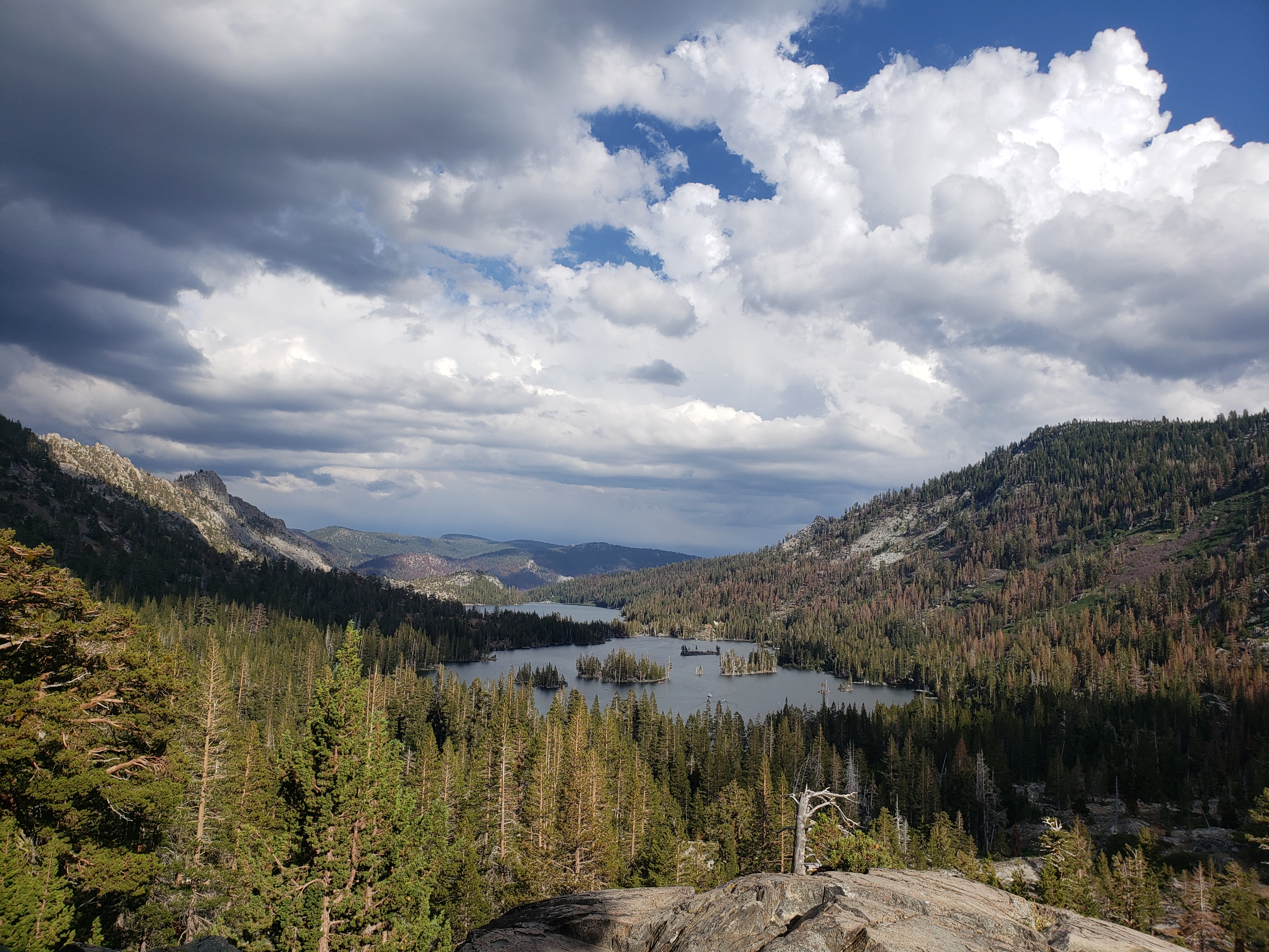
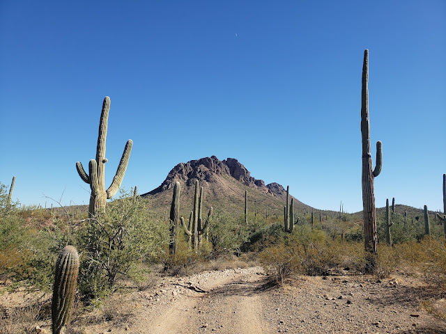
The Desert Winter Thru Hike holds tremenous potential.

Rejected Candidates

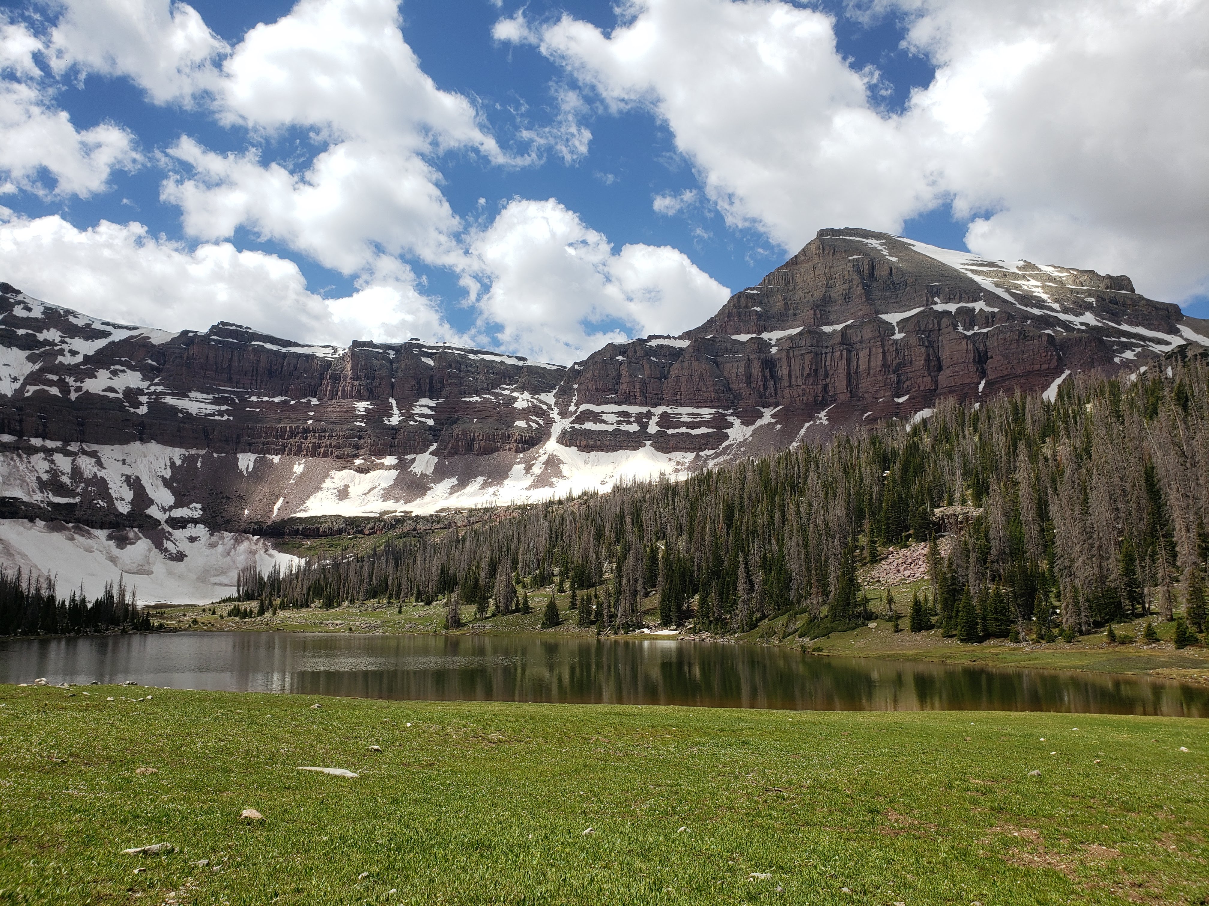
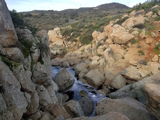
When I was a college freshman, I headed down to Great Smoky Mountain National Park over spring break with a few friends for our first-ever backpacking trip. Spring break in the south! It'll be warm and pleasant, right? Wrong.  We trudged through multiple feet of snow, slid off the road once, and even got a good old-fashioned case of hypothermia. I was cold and miserable most of the time. To put it charitably, the trip was a flop.

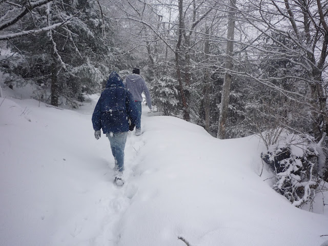
Photo: Jake Vriesema

To this day, I see people making the same mistake. Northerners like me seem to underestimate the effects of elevation. Just because a trail is in the "south" doesn't mean it's warm and pleasant in the depths of winter. The following trails, despite being located in southerly climes, are largely at high elevation, and would be unpleasant at best in the depths of winter:

  • Arizona Trail
  • Sky Islands Traverse
  • Grand Enchantment Trail
  • Hayduke Trail

Is it possible to do these trails in winter? Yes, and some of them have been done already. But by that standard, the Pacific Crest Trail has been done in the winter, and I certainly don't think anyone would call the PCT a "winter thru-hike". Hikers attempting any of these trails in the winter will be doing them explicitly out-of-season, and will face many challenges not present during the prime hiking season. 

It should be noted that most of these routes do have sections that dip down into the low elevations. The stretch of the Arizona Trail north of Oracle comes to mind as an obvious instance. Certain sections would be perfectly doable in the winter, however I wouldn't advise attempting a thru-hike of the whole thing unless you're prepared for a whole lot of unpleasantness and truly four-season conditions.

Marginal Candidates

A few years ago, hiker extraordinaire Cam "Swami" Honan walked Arkansas's Ouachita Trail in January/February. He evidently enjoyed it, and wrote a very positive review of the trail. Since that time, I've seen countless online acolytes refer to the OT as a "winter thru hike". And while it's certainly possible to hike the OT in the winter (even if you're not a top-notch adventurer like Swami), there's some context that's missing.

Swami did the OT as part of his stunning "12 Long Walks" project, in which he hiked many of North America's foremost hiking trails in one year-round, 18-month push. Of course, that meant finding trails to do in the winter. Among them was the OT. He hiked the OT not because it was at its very best in the winter, but because it was possible, pleasant, and lined up well with his schedule. 

Put another way, if your goal was to hike the Ouachita Trail at its best, and there were no other considerations, you probably wouldn't hike it in January. The OT and its brethren are perfectly suitable for winter thru-hiking, but frankly, are best enjoyed at a different time of year. Off the top of my head, there are several such trails:

  • Ouachita Trail (223 mi)
  • Ozark Highlands Trail (164 mi)
  • Palmetto Trail (~500 mi, unfinished)
  • Pinhoti Trail (335 mi)
  • Benton MacKaye Trail (287 mi)

It's possible to hike all of these trails in the winter. Temperatures may be cool (or even downright cold at night), but it warms up during the day. Snow and ice may be a factor, but snowpack doesn't hang around all winter and continue to accumulate.

But it's hard to argue that any of these trails are at their best during the winter. Hiking a trail through the  leafless hardwoods can be a little monochromatic in the winter. Sure the views are marginally better, but those dead and brown trees don't exactly inspire a soaring feeling of wonder as you hike through the woods. And though they're well south of the Mason-Dixon line, each of these trails (especially at higher elevations) can see snow/frost/cold temperatures. On the Ozark Highlands Trail (early March 2018), I had nights in the single digits, and four consecutive days where the mercury didn't even reach the freezing mark. 

This isn't to dissuade anyone from doing these trails in the dead of winter. Even imperfect time spent outside is better than rotting on the couch. But there are other, possibly better, candidates out there.
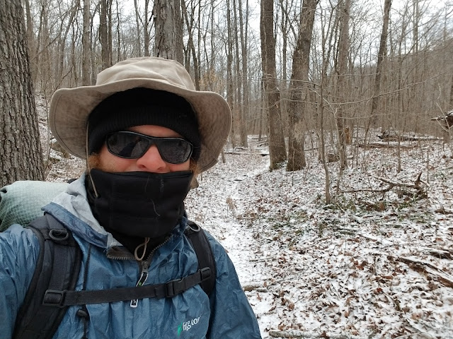
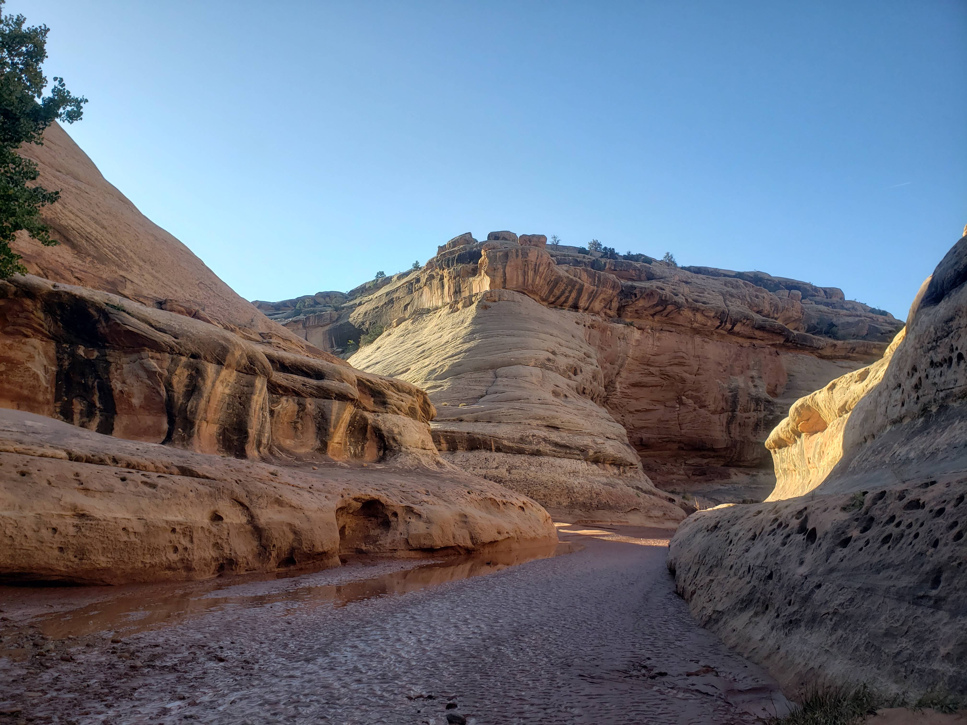
Doable. Not ideal.

Prime Candidates:

As far as I'm concerned, there are really only two US long-distance routes that are at their best during the depths of winter (December-February) - the Florida Trail and the Desert Winter Thru Hike. We'll discuss each of them in turn:

Florida Trail

For many years, the Florida Trail has been the default choice for long-distance hikers looking to stretch their legs in the winter. Let's start with some fast facts:

  • 1,100 miles long
  • Federally-designated National Scenic Trail
  • Southern terminus: Big Cypress National Preserve
  • Northern terminus: Gulf Islands National Seashore
  • 70% trail, 30% (mostly paved) roads
  • No appreciable elevation gain/loss
  • Numerous towns/resupply points. Resupply is a breeze, at least if you're okay eating out of nothing but Dollars General for 500 miles.

The FT often carries a bum rap among thru-hiker types. They scoff at the completely flat elevation profile, lack of pristine wilderness, or abundant road miles. They're often scared off by the pounding that feet take on the FT, the swamps/wet conditions, and the bugs. All of those are fair criticisms. 

But here's what they're missing: The forests on the FT are incredible. Far from being boring green tunnels like they often are on other trails, the FT's forests are varied. They're dense, often with interlocking branches above. The palm and oak hammocks are something to behold. And while the swamps are certainly soggy, they're among the most unique and interesting parts of the trail. FT volunteers have worked tirelessly to bridge the deepest water with some truly spectacular bridges. The FT passes through varied ecosystems, from the Everglades in the south to pine forests in the middle to a white sand beach in the north. Along the way, you walk along idyllic rivers, one of which (the Aucilla) randomly dives into a series of karst sinkholes and soon thereafter disappears entirely. How cool is that!


The only realistic hiking season for the FT is the dead of winter. The rest of the year can be ruled out due to oppressive heat, hideous bugs, and high water left over from tropical storms. While you'll probably have a few chilly nights in the panhandle and a few sweltering nights in the south, overall, temperatures are fairly pleasant and mild. The swamps would require a dinghy in the summer; in the winter, they're passable on foot.

The FT can be hiked in either direction (northbound or southbound) during the winter months (Dec-Mar). Most hikers start in south after celebrating Christmas/New Years with their families, working their way north as the weather warms. Hikers generally finish in late February or March.

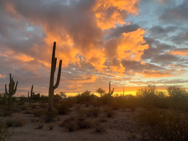
Desert Winter Thru-Hike

As its name implies, the Desert Winter Thru Hike is designed to be walked during the dead of winter. It stays generally in low-elevation terrain of the Sonoran and Mojave deserts. The fast facts:

  • ~750 miles long
  • Unofficial "route" created by Brett "Blisterfree" Tucker (of Grand Enchantment Trail fame)
  • Eastern terminus: Saguaro National Park
  • Western terminus: Joshua Tree National Park
  • 50% dirt roads, 40% cross-country, 10% trail
  • Modest elevation gain/loss
  • Tough resupply situation. By necessity, most towns have walk-in/walk-out access. With few exceptions though, they're tiny hamlets with few services.

Most of the "dirt road" miles are like this. Zero traffic, just double-wide trail.

We need to be very clear about one thing up-front: the Desert WTH is a route, not a trail. There's no dedicated trail tread (indeed, in this hardscrabble country, trails are a rarity). There's a ton of cross-country on this route, though most of it follows natural handrails like canyons or ridges. This route definitely falls into the "experts only" category.

Compounding the challenge, the Desert WTH is still in its adolesence. Though Blisterfree is fastidious about gathering beta, the reality is that the Desert WTH is still only a couple years old, is not yet finalized, and to date has seen zero completions. 

All that said, the Desert WTH is, in my opinion, most beautiful, wild, and rewarding trail mentioned in this article. To date, I've only done the eastern (Arizona) half, and am more than a little stoked to walk the California portion at some point in the future. Unlike wetter climes, the deserts look just as beautiful in the winter as they do in the summer, and the sunsets are often picture-perfect. For hikers with tens of thousands of trail miles to their names, I think the WTH will quickly become a preferred option in coming years.

Shorter Candidates

Beyond the FT and Desert WTH, there are a few shorter trails that are in-season in the dead of winter. Whether these trails qualify as "thru-hikes" is an arcane debate that I don't care to indulge, but these are all trails that can be done on either zero or one resupply. Hiking time would be anywhere from 4-12 days.

San Diego Trans-County Trail

For its length, the SDTCT is a surprisingly diverse trail. Some fast facts:

  • ~160miles long
  • Official county trail, but with many gaps that have been filled in by unofficial connections over the years
  • Eastern terminus: Salton Sea (below sea level!)
  • Western terminus: Torrey Pines State Park, Pacific Ocean
  • 65% trail, 20% dirt roads, 15% pavement
  • Significant private property/access concerns
  • Easy resupply situation
  • Most folks will want to cache water for a couple of long dry stretches.  

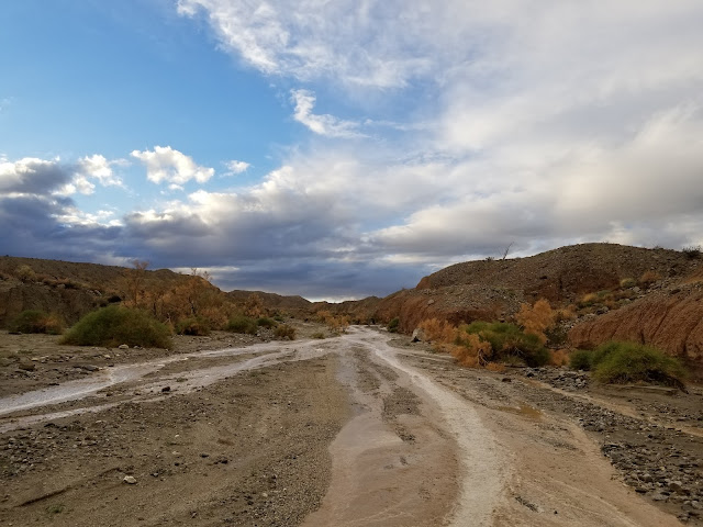
Normally dry wash, flowing after the winter rain nourishes this Mediterranean climate. Bring a rain jacket.

The SDTCT begins in a rugged, waterless desert next to the stinking Salton Sea. It crosses badlands, low mountain ranges, a significant river canyon, several neighborhoods of suburban San Diego, an urban greenway corridor, and splashes its way to an end in the Pacific Ocean. It's incredibly diverse; in just 150 miles, it contains both a 40-mile waterless stretch and a Costco. The eastern half is pretty remote; the western half is built up enough that finding a campsite can be a challenge. Even though the entirety of the trail isn't remote, unbroken wilderness, I still really enjoyed it.

Private property is a concern, and unfortunately there will be several times along the SDTCT where you'll feel distinctly unwelcome, even if what you're doing isn't strictly speaking illegal. I'd encourage anyone who seeks to undertake the journey to be respectful, stealthy, and understand the private property issues prior to undertaking.

Burbling brook in the foreground, high-voltage lines in the background. Hiking in the urban/rural interface is certainly unique.

Lone Star Hiking Trail 

I haven't done the Lone Star Trail and have no first-hand experience with the area. Some fast facts:

  •  96 miles long
  • Designated as a National Recreation Trail
  • Has a legit, active trail organization
  • Located in the Sam Houston State Forest, north of Houston.

On the other hand, reader Sisu has hiked the LSTH and offers her thoughts. She appreciated the warm Texas midwinter weather, the modest length and difficulty, and the easy navigation. There was no dangerous wildlife to contend with, aside from a few ticks.

On the other side of the ledger? She found the trail conditions to be a wet, "juicy mess". the scenery to be pretty lackluster, and the water quality to be surprisingly poor. Aggressive dogs on roadwalks and a tough camping situation rounded out the challenges on this route. In summary? 

Bottom line, if someone asked me about my honest opinion about the LSHT, I'd respond with: Don't waste your time. You can do better.

Like with any trail, opinions vary. I hate to say it, but hiking a midwinter trail in North America does often imply lowering your standards a little bit*. No one is going to confuse the Lone Star Hiking Trail for the John Muir Trail, or the Florida Trail for a Greater Yellowstone Loop. But that's okay. 

*In my opinion, the Desert Winter Thru Hike is the exception to this rule, but I'm admittedly a huge fanboy of that route so you should probably take this with a grain of salt.

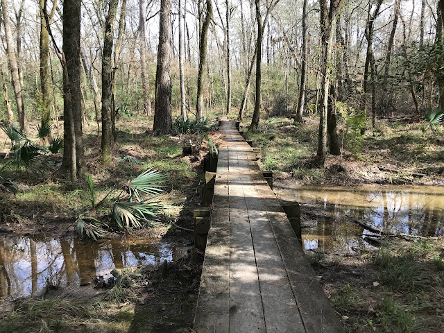
Photo courtesy of Sisu
 

Big Bend 100

I've only done a few miles of the Big Bend 100 (where it overlaps with the Outer Mountain Loop in Big Bend National Park), but think the route has a lot of potential. Some fast facts:

  • 100 miles long 
  • 50% trail, 30% dirt road, 20% off-trail
  • Unofficial "route"
  • Western Terminus: Casa Piedra Trailhead, Big Bend Ranch State Park
  • Eastern Terminus: Chisos Basin, Big Bend National Park
  • Split roughly evenly between national park and state park land.
  • Tough logistics/transportation between termini

This one's another expert-level trail. I haven't done the "hard" (i.e. off-trail) parts, as the 2019 government shutdown scuttled my plans, but would expect it to be on par with the Hayduke for navigational and water difficulty. The route's "official" website has been taken down recently for unknown reasons, so do your homework if you want to attempt this trail. Reading between the lines, I suspect there's some significant red tape associated with hiking this trail, with the National Park's permit system being of particular concern.

Considerations for winter hiking

Even for hiking trails that are at their best during the winter, things are still a little bit different in the winter vis-à-vis three-season hiking. 

Short Daylight

In early January, the sun is only up in Miami for 10.5 hours. For points more northerly (e.g. the rest of the country), there's even less daylight. This has two implications.

First, expect to scale back your daily mileage. During three-season conditions, I typically do about 25 miles/day on the major western trails, and most of those trails are far more physically demanding than either the Florida Trail or Desert Winter Thru Hike. Despite that, I found that my daily mileage on both the FT and Desert WTH was only around 20 miles/day. I constantly found myself running out of daylight. I could certainly do bigger miles, but it would involve night hiking. I advise anyone looking to thru-hike in the winter to scale back their mileage expectations relative to the long days of summer.

Second, find ways to pass the long nights. Even while hiking, I can't sleep for 13 hours, night after night. I generally find myself falling into an exhausted sleep soon after dark, waking up for an hour or two in the middle of the night, and then falling back asleep til morning. Apparently this sleep pattern was common in the long winter nights of pre-industrial Europe. I recommend bringing a deck of cards, a book, or some other form of entertainment. I also use the nighttime interregnum to do a significant fraction of my daily eating. I'm awake anyway, so why not? It allows me to make better use of my limited daylight to hike and see stuff, rather than taking an hour lunch.

Sunrise and sunset seem to consume half the daylight hours during the winter

Less Human Presence

Particularly for trails in the "Marginal Candidates" bucket, I find that trails are much quieter during the winter. Most casual outdoors-types who live in warm climates aren't particularly enthused about going out in cold weather (at least by their standards). On my Ouachita and Ozark Highlands Trails hikes, I met a grand total of 4 people over 400 miles. Had I hiked in the dead of winter instead of during the winter/spring transition, I probably met even fewer.

With shoulder-season hiking comes certain challenges though. Campgrounds and seasonal businesses may be closed. Water faucets at campgrounds and visitors centers may be shut off. If you're planning to hike a Marginal Candidate durin the winter, make sure you do your research beforehand!

Reduced Physical Fitness

A friend of mine refers to this as the "Winter Manatee, Summer Dolphin" phenomenon, and I don't think it's limited to long-distance hikers. Understandably, most people simply aren't as active in the winter as they are in the summer.

Hikers are particularly susceptible to this phenomenon, though. Many of them will have completed a long-distance hike in September or October, and will have adjusted their expectations over the course of that hike. They now see 25-30 mile days as the new normal, and may not fully appreciate just how tough a 25 is for someone "coming off the couch". After a couple months of reduced physical activity and still eating 3,000 calories/day, trying to do big miles during the dead of winter may be a rude awakening indeed. 

All in all then, even experienced thru-hikers would do well to ease themselves into the hiking life and allow their bodies to acclimate to the rigors of on-trail life.

Worth It?

There's no way around it - long-distance hiking options are limited during the North American winter. Nevertheless, a winter thru-hike can be delightful. I think that the Desert Winter Thru Hike in particular has a ton of potential as a delightful midwinter journey for very experienced route hikers. But even if you're not up for something that long or difficult, the shorter candidates, or a section of the Florida Trail may be just what you need to ward off the winter manatee. And let's not pretend there's not a certain delight in enjoying the warm sunshine while our friends and family in colder states are complaining about yet another foot of snow!